Drone photography for real estate listings

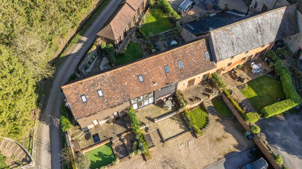
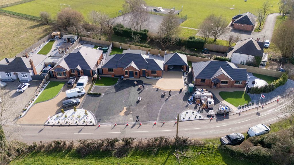
Some properties can’t be sold from the ground. A long garden, a paddock, a corner plot, a home that backs onto fields: a ground-level photo shows a fence and a lawn, but buyers want to see the whole picture. Real estate drone photography shows the boundaries, the gardens, the driveway and what’s around the property, so buyers understand the plot before they book a viewing.

We fly for estate agents, developers and private sellers. Most drone shoots are added to a photography shoot on the same visit, so you only need one appointment.

Book a drone shoot Call 07730 577404

Photos in 24 hours · Video from 48 hours · Floor plans within 24 hours · Based in Bromsgrove
What aerial shots show buyers

  • Full boundaries and plot size. Where the garden really ends, and how much land comes with the house.
  • Gardens, driveways and outdoor features. Patios, outbuildings, parking and anything a buyer would otherwise only see on the viewing.
  • The setting. How close the countryside, schools and transport are, and how the home sits on its street.
Drone Property Photography

Best suited to

Country homes, large plots, new developments, commercial premises and holiday lets. For a typical home on a tight street, aerial shots usually add less, so ask us if you’re not sure.

drone property photography

What you get

  • Aerial stills, edited and ready for the portals.
  • Aerial video in HD to 4K, if you want it, for portal video slots, social reels or an opening shot for a property video.
  • Fast delivery: photos within 24 hours and video from 48 hours.
Drone photography for Real Estate

Planning the shoot

When you book, give us the address and tell us what matters most about the plot: the length of the garden, a paddock, the view or how close the property is to the village. We’ll plan the aerial shots around those selling points. If the vendor has outbuildings, a pool or land that isn’t obvious from the road, mention it too, so nothing important is missed on the day.

Safe, legal flying

Craig flies every shoot himself. He holds CAA drone credentials and drone insurance, is fully DBS checked and carries £1 million public liability insurance. Whether a flight can go ahead depends on the airspace and the weather. Some areas are no-fly zones, and we fly only in safe conditions. If wind or rain rules a flight out, we rebook it.

Add drone to your shoot

Aerial shots work best as part of the full set:

  • Real estate photography: 20 edited photos delivered within 24 hours, with blue skies, watermarks and blurring as standard.
  • Property video: HD to 4K walkthroughs of about 1.5 minutes, with a drone opening if you like.
  • 360 tours on Matterport or Vieweet.
  • Floor plans within 24 hours, from £5.99.

Not after marketing shots? For dated images of a roof’s condition, see our drone roof surveys. For more on everything we do in the air, visit the drone property photography page.

Where we fly

We’re based in Bromsgrove, and Worcestershire is our main area. We also cover Redditch, Kidderminster, Worcester, Stourbridge, Birmingham, Warwick, Alcester and the places in between. Shoots run Monday to Friday, 9–5.

Frequently asked questions

What does drone photography add to a listing?

It shows the plot, gardens and setting from above: the things a ground-level photo can’t show.

How quickly do I get the aerial photos?

Photos are delivered within 24 hours, and aerial video from 48 hours.

What happens if the weather is bad?

We fly only in safe conditions. If wind or rain rules it out, we rebook the flight.

Are you licensed and insured to fly?

Yes. Craig holds CAA drone credentials and drone insurance, and carries £1 million public liability insurance.

Can you fly anywhere?

Not everywhere. Airspace rules and no-fly zones apply, so tell us the address when you book and we’ll check it.

Get in touch

Mon–Fri 9–5. Ready to book? Call 07730 577404, email info@bricksandmedia.com or send an enquiry.